For municipalities
Manage municipal forest digitally — start simply, no limits.
For municipal forestry operations, district managers and town foresters: digitalise timber capture from the field to the office — fully digital, with transparent pricing and no hidden costs.
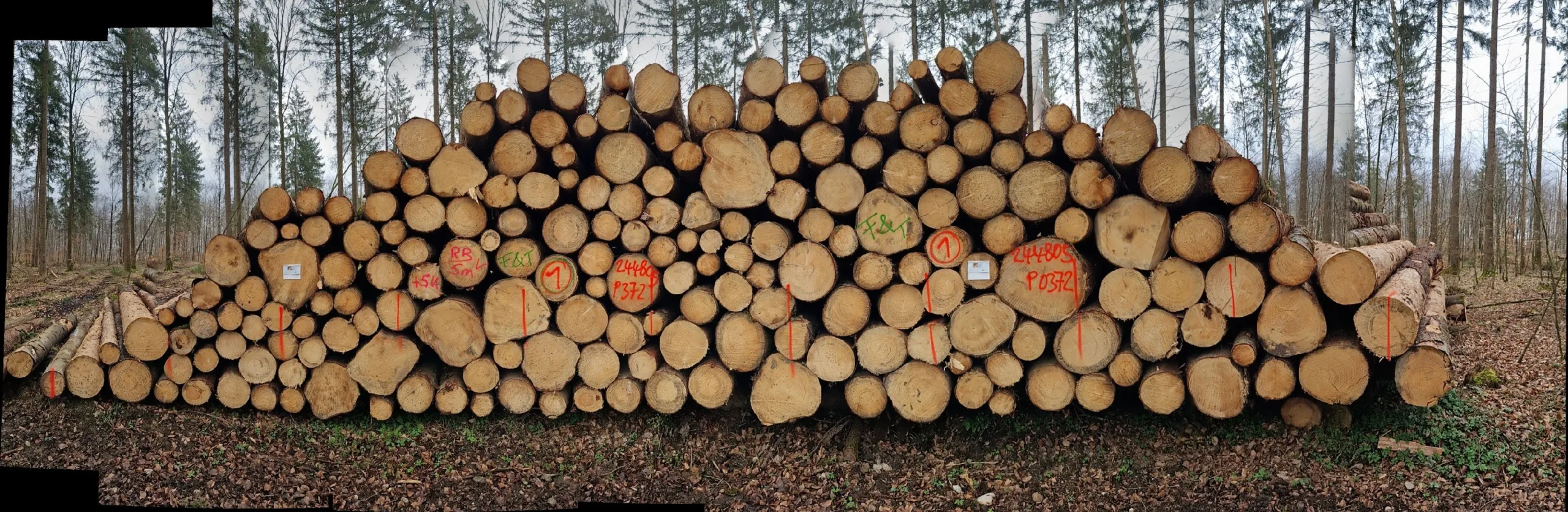
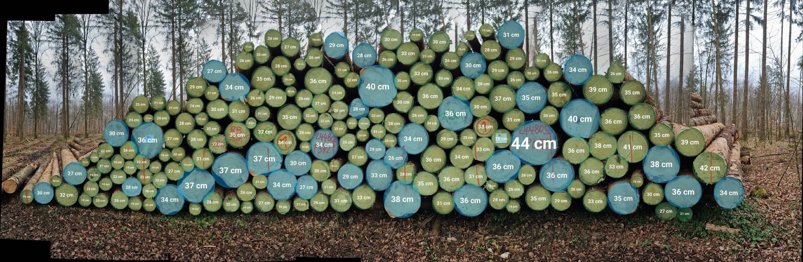
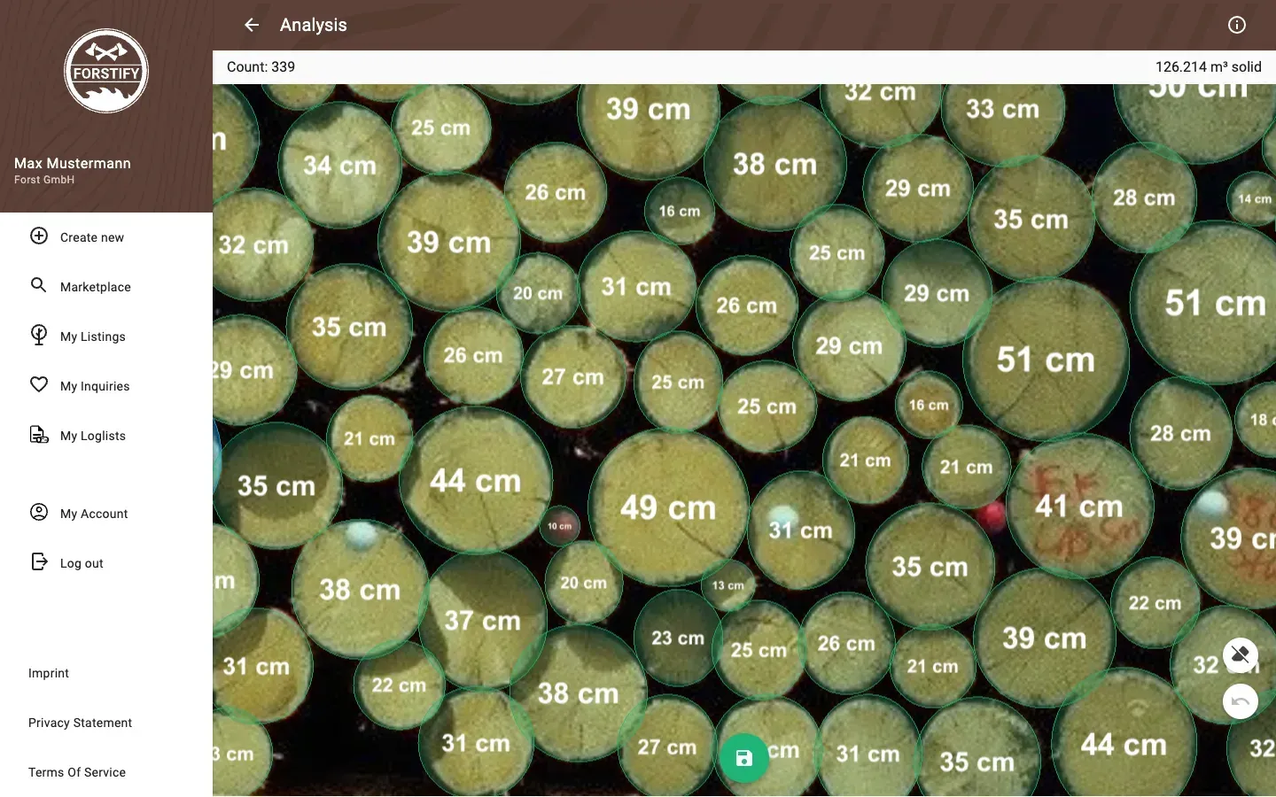
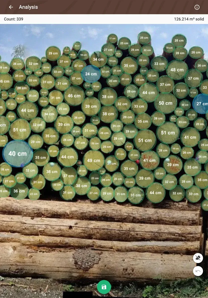
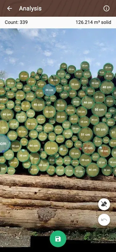
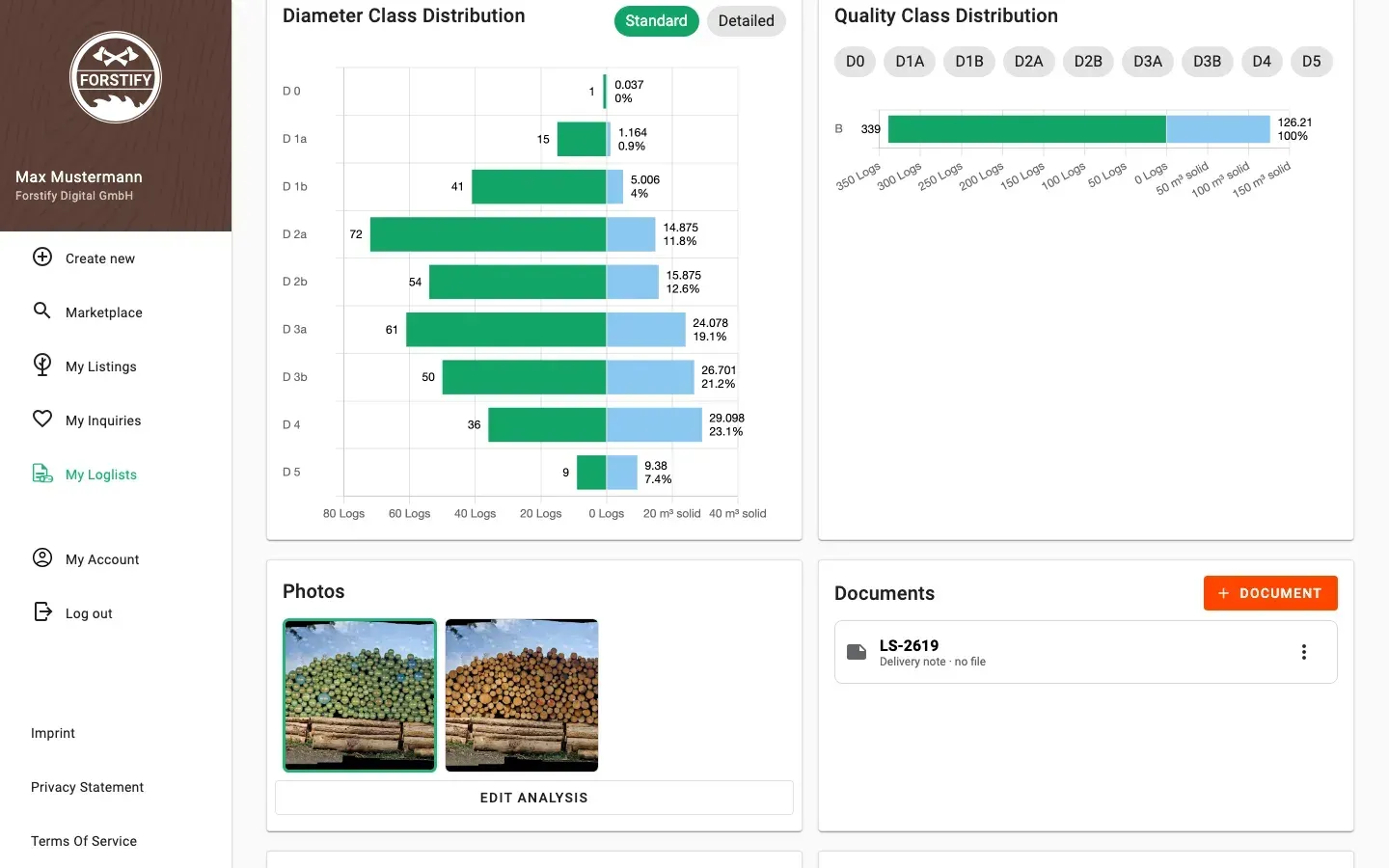
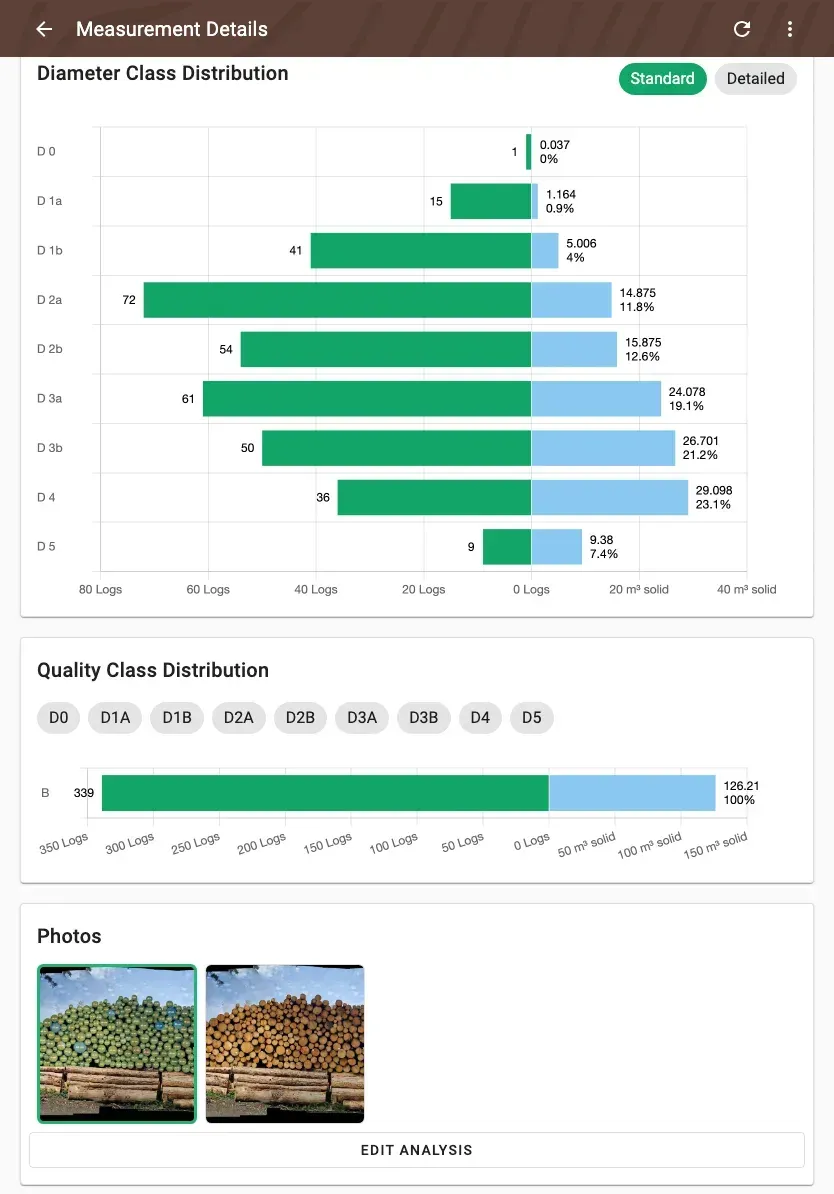
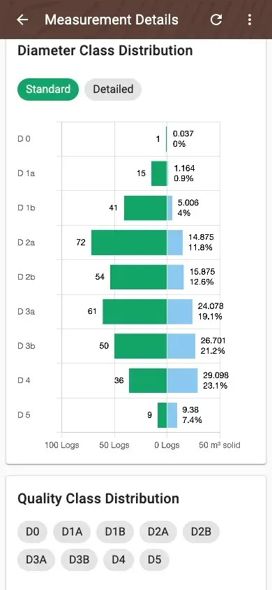
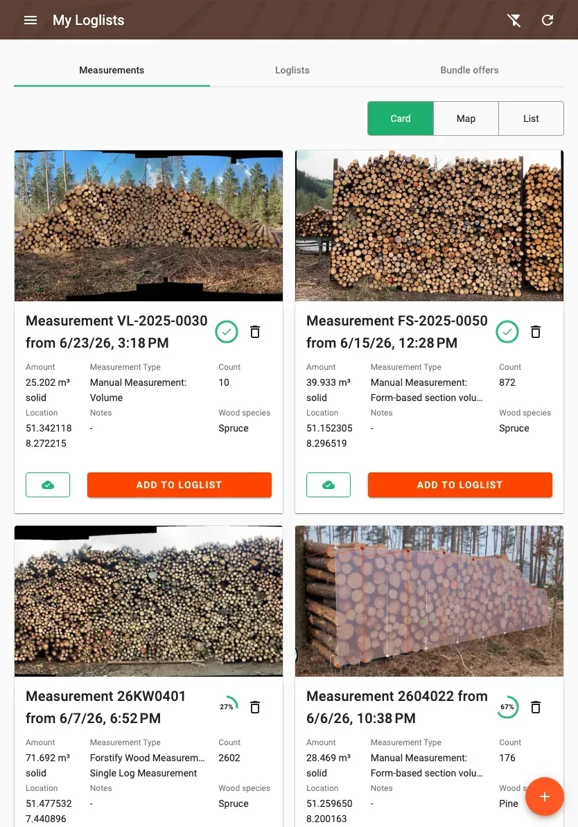
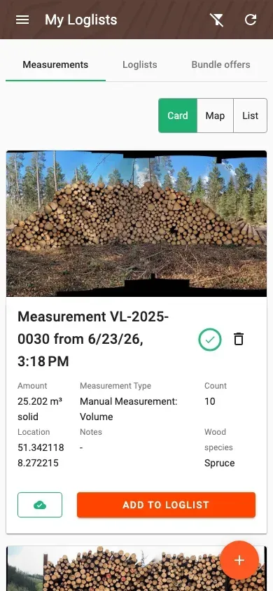
Forstify Measurement & photo analysis
Count and measure thousands of logs in seconds.
Get started easily
Measure simply and fast — every assortment
Capture piles with your phone in seconds. Standardised and auditable — no expensive gear, no training overhead.
- Measure piles with your phone in seconds
- Standardised & auditable
- No prior knowledge, no expensive gear
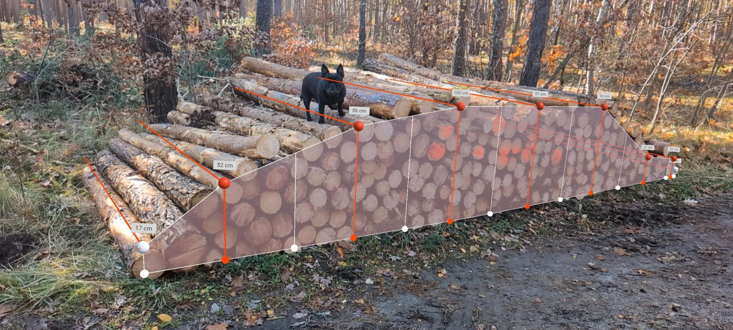
Forstify Sectional Volume Measurement
Capture pile width, heights, stacked and solid volume in seconds.
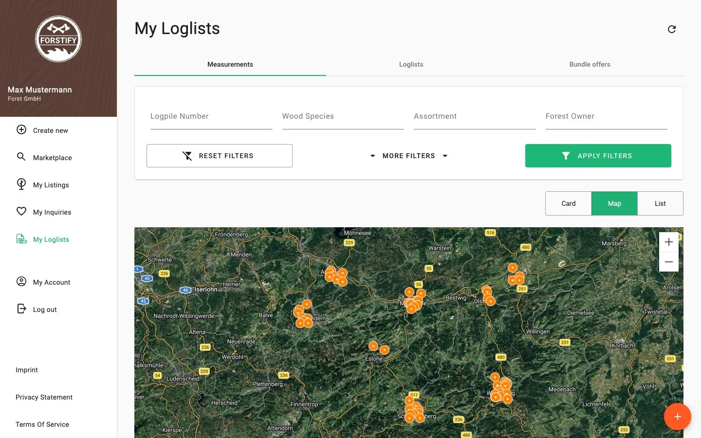
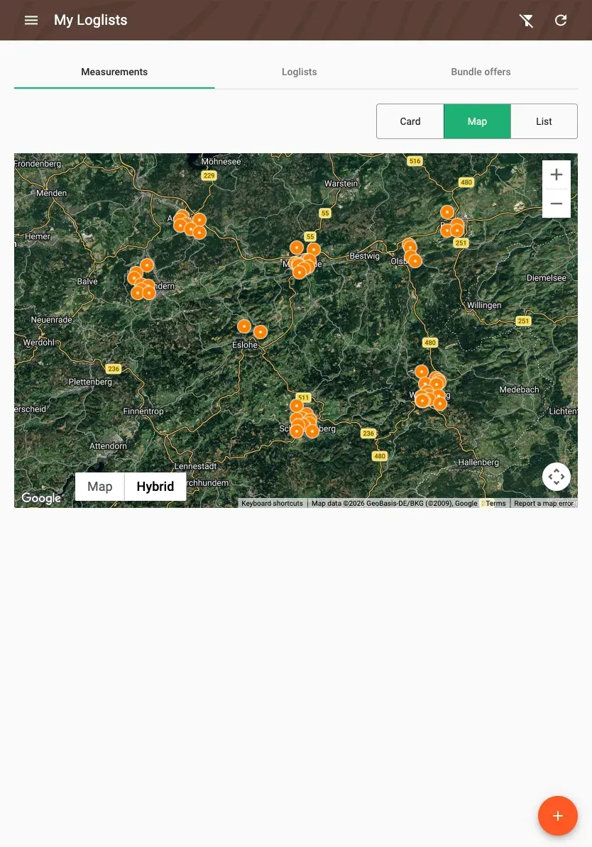
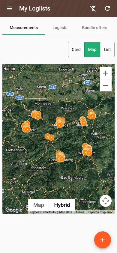
In the district
Capture in the district — with location and map
Every record with photos, location and assortment — across all districts on the map. Works offline in the forest, too.
- Measure piles digitally & consistently
- Photos, location & assortment per record
- Every district on the map
To the office
Real-time to the office — fully digital
Data is processed automatically and instantly available to administration — including diameter and quality analysis per record.
- Data processed automatically
- Instantly available to administration
- Diameter & quality analysis per record
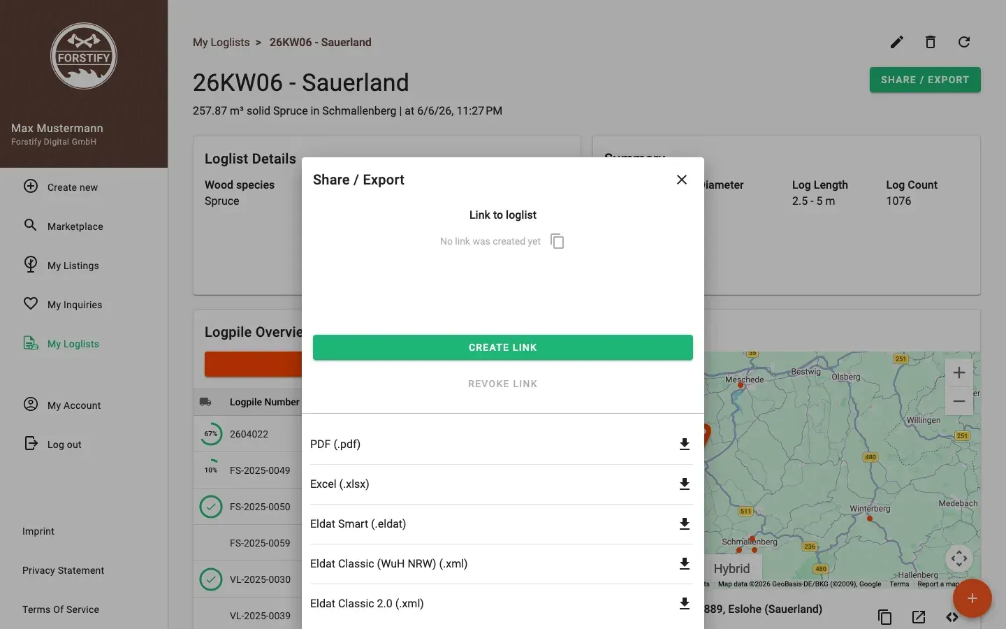
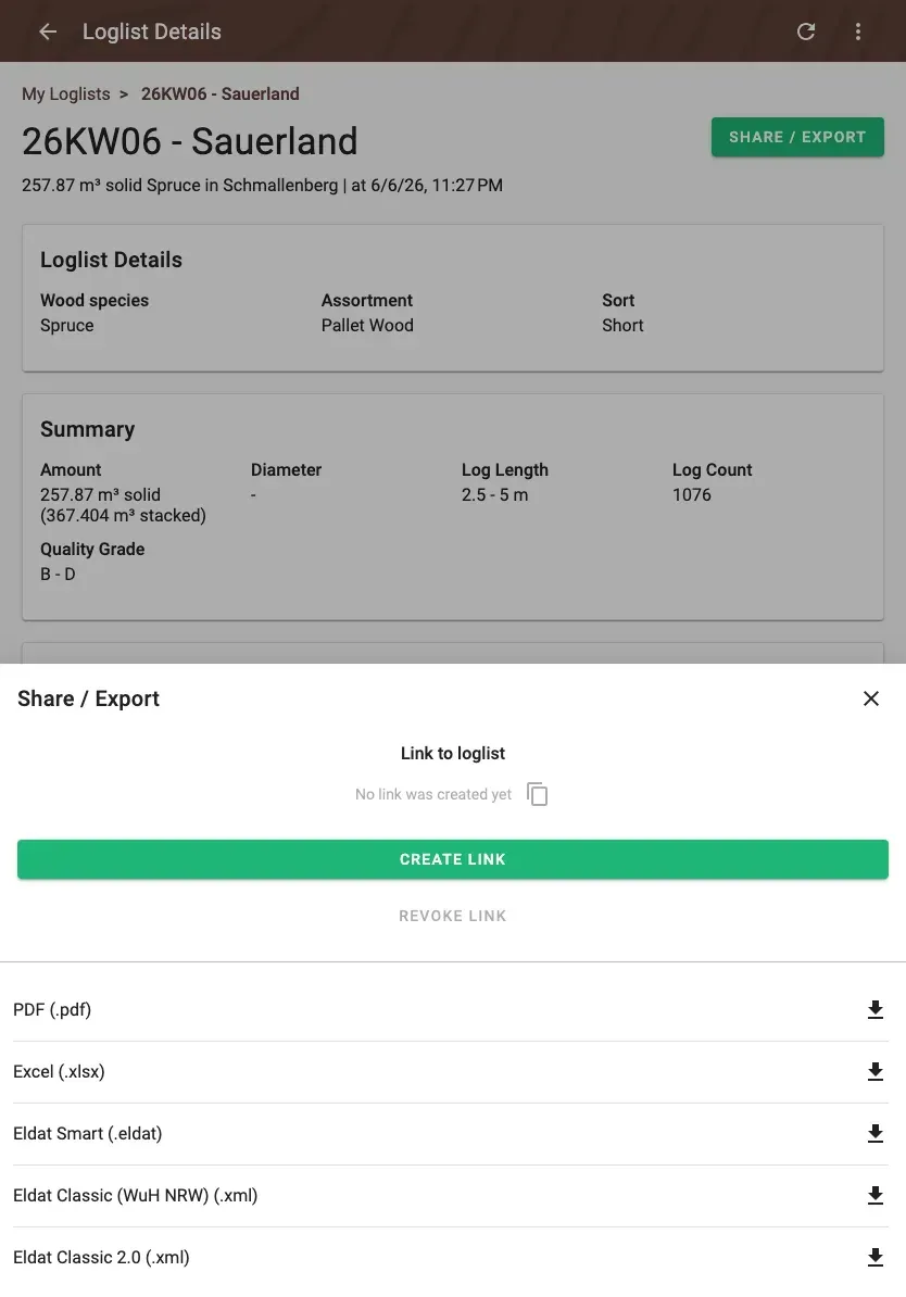
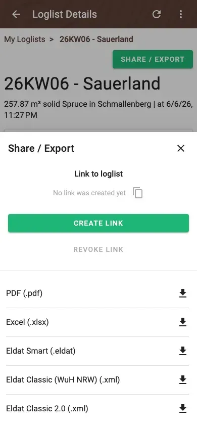
Documentation
Documentation and records at the touch of a button
Export records and analyses as PDF, Excel or ELDAT — auditable and verifiable for administration and committees.
- Export as PDF, Excel or ELDAT
- Auditable, verifiable documentation
- Share records — with administration or buyer
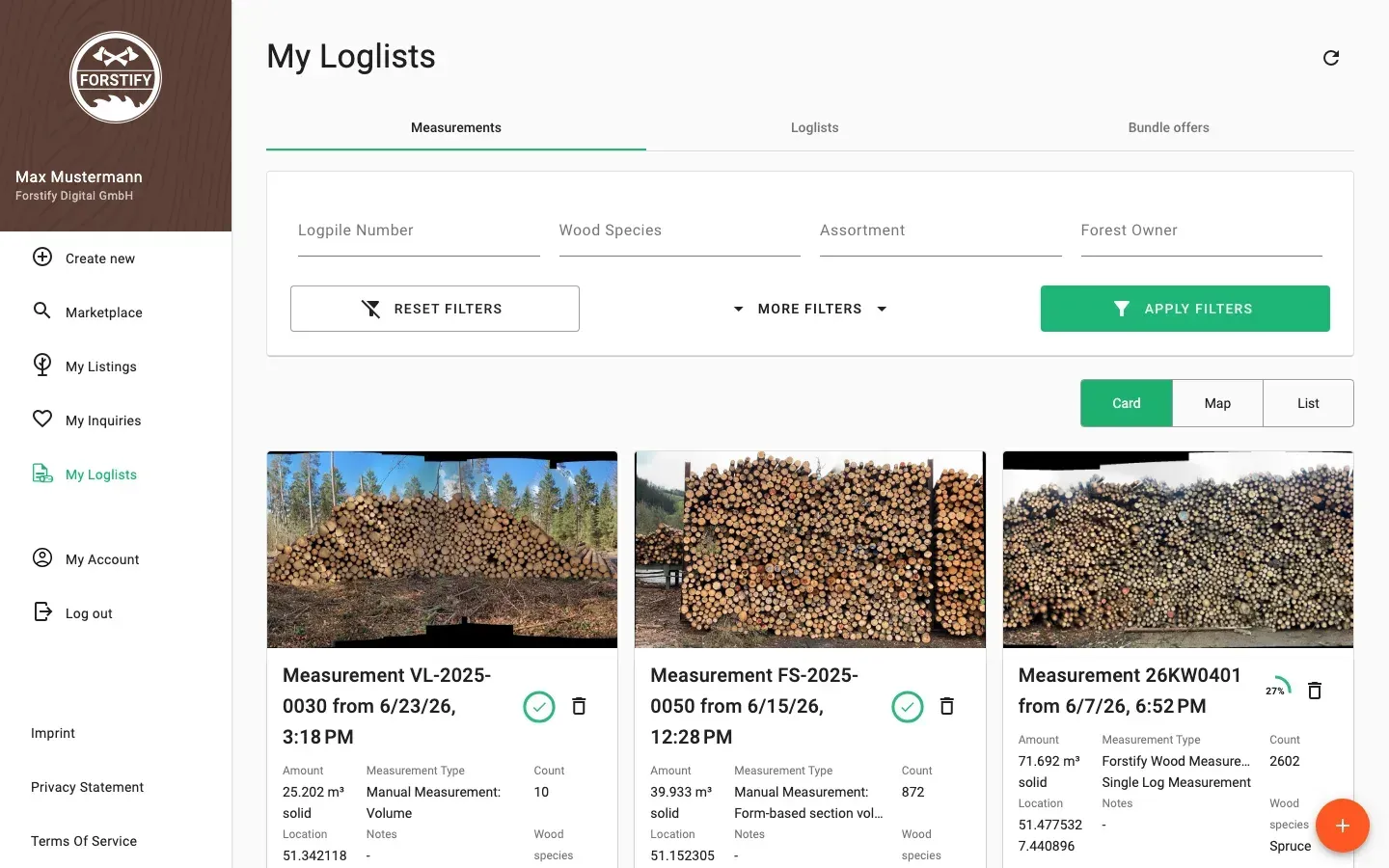
Overview
The whole municipal forest at a glance
Every record structured in one place — across districts and assortments. Better overview of volumes, values and supply.
- Every record structured in one place
- Filter by district & assortment
- Volumes, values & supply in view
Related features
Start digitalising your forestry administration.
We will walk you through the municipal license in a short demo.